Public domain
Big Bend National Park
From the collection of NASA Image and Video Library. Free to download, adapt and use — no permission needed.
About this work
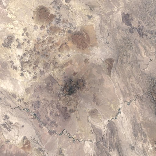
Alternately known as a geologist’s paradise and a geologist’s nightmare, Big Bend National Park in southwestern Texas offers a multitude of rock formations. Sparse vegetation makes finding and observing the rocks easy, but they document a complicated geologic history extending back 500 million years. On May 10, 2002, the Enhanced Thematic Mapper Plus on NASA’s Landsat 7 satellite captured this natural-color image of Big Bend National Park. A black line delineates the park perimeter.
NASA Image and Video Library’s own descriptionSubjects
Credit lineBig Bend National Park. NASA/GSFC, 2017-12-08. Public domain. ID: GSFC_20171208_Archive_e000237.