![East Peak Fire Burn Scar, Colorado [high res]](https://thumbs.arkivism.com/nasa-GSFC_20171208_Archive_e001431.jpg)
Public domain
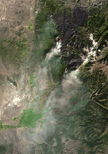
East Peak Fire Burn Scar, Colorado [high res]
From the collection of NASA Image and Video Library. Free to download, adapt and use — no permission needed.
About this work
On June 22, 2013, the Operational Land Imager (OLI) on Landsat 8 captured this false-color image of the East Peak fire burning in southern Colorado near Trinidad. Burned areas appear dark red, while actively burning areas look orange. Dark green areas are forests; light green areas are grasslands. Lightning ignited the blaze on June 19, 2013. By June 25, it had burned nearly 13,500 acres (5,500 hectares).
NASA Image and Video Library’s own descriptionCredit lineEast Peak Fire Burn Scar, Colorado [high res]. NASA/GSFC, 2017-12-08. Public domain. ID: GSFC_20171208_Archive_e001431.