Public domain
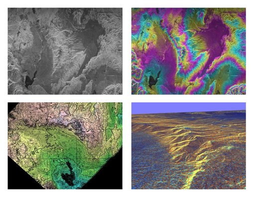
Space Radar Image of Long Valley, California -Interferometry/Topography
From the collection of NASA Image and Video Library. Free to download, adapt and use — no permission needed.
About this work
These four images of the Long Valley region of east-central California illustrate the steps required to produced three dimensional data and topographics maps from radar interferometry. All data displayed in these images were acquired by the Spaceborne Imaging Radar-C/X-band Synthetic Aperture Radar (SIR-C/X-SAR) aboard the space shuttle Endeavour during its two flights in April and October, 1994.
NASA Image and Video Library’s own descriptionSubjects
Credit lineSpace Radar Image of Long Valley, California -Interferometry/Topography. NASA/JPL, 1999-05-01. Public domain. ID: PIA01770.