Public domain
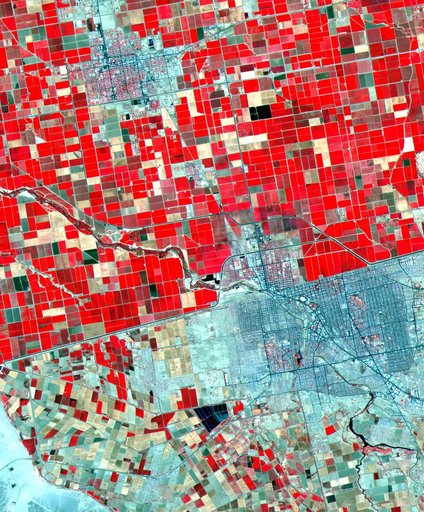
ASTER Mexicali
From the collection of NASA Image and Video Library. Free to download, adapt and use — no permission needed.
About this work
Dramatic differences in land use patterns are highlighted in this image of the U.S.-Mexico border. Lush, regularly gridded agricultural fields on the U.S. side contrast with the more barren fields of Mexico. This June 12, 2000, sub-scene combines visible and near infrared bands, displaying vegetation in red. The town of Mexicali-Calexico spans the border in the middle of the image; El Centro, California, is in the upper left.
NASA Image and Video Library’s own descriptionCredit lineASTER Mexicali. NASA/JPL, 2000-10-06. Public domain. ID: PIA02659.