Public domain
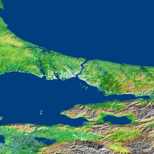
Shaded Relief and Radar Image with Color as Height, Bosporus Strait and Istanbul, Turkey
From the collection of NASA Image and Video Library. Free to download, adapt and use — no permission needed.
About this work
The Bosporus also spelled Bosphorus is a strait that connects the Black Sea with the Sea of Marmara in the center of this view of northwest Turkey, taken during NASA Shuttle Radar Topography Mission.
NASA Image and Video Library’s own descriptionSubjects
Credit lineShaded Relief and Radar Image with Color as Height, Bosporus Strait and Istanbul, Turkey. NASA/JPL, 2002-04-22. Public domain. ID: PIA03349.