Public domain
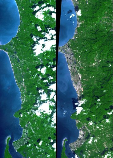
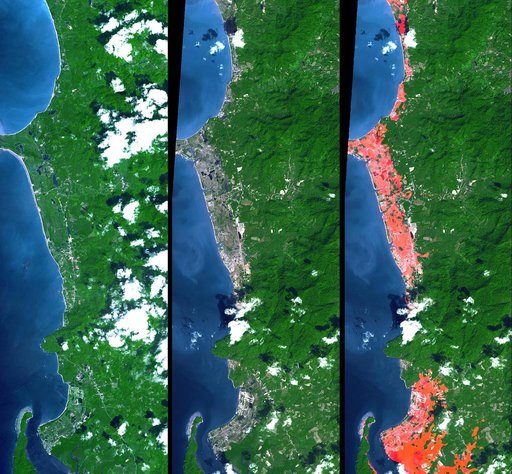
Tsunami Inundation, North of Phuket, Thailand<br />ASTER Images and SRTM Elevation Model
From the collection of NASA Image and Video Library. Free to download, adapt and use — no permission needed.
About this work
This image from NASA Terra spacecraft shows the Indian Ocean coastline north of Phuket, Thailand is a major tourist destination that was in the path of the tsunami produced by a giant offshore earthquake on December 26, 2004.
NASA Image and Video Library’s own descriptionSubjects
Credit lineTsunami Inundation, North of Phuket, Thailand<br />ASTER Images and SRTM Elevation Model. NASA/JPL, 2005-01-14. Public domain. ID: PIA06671.