Public domain
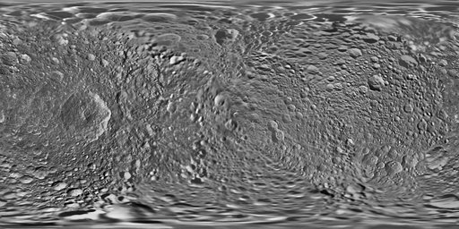
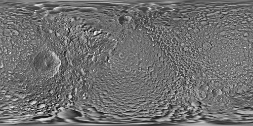
Mimas Global Map - June 2017
From the collection of NASA Image and Video Library. Free to download, adapt and use — no permission needed.
About this work
This global map of Saturn's moon Mimas was created using images taken during Cassini spacecraft flybys. The moon's large, distinguishing crater, Herschel, is seen on the map at left. The map is an equidistant (simple cylindrical) projection and has a scale of 710 feet (216 meters) per pixel at the equator. The mean radius of Mimas used for projection of this map is 123.2 miles (198.2 kilometers). The resolution of the map is 16 pixels per degree.
NASA Image and Video Library’s own descriptionSubjects
Credit lineMimas Global Map - June 2017. NASA/JPL, 2017-06-13. Public domain. ID: PIA17214.