Public domain
Zambezi River Delta
From the collection of NASA Image and Video Library. Free to download, adapt and use — no permission needed.
About this work
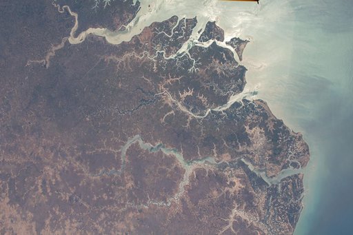
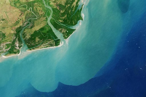
It drains a watershed that spans eight countries and nearly 1.6 million square kilometers 600,000 square miles. The Zambezi also Zambeze is the fourth largest river in Africa, and the largest east-flowing waterway. The Operational Land Imager on the Landsat 8 satellite acquired this natural-color image of the Zambezi Delta on August 29, 2013. Sandbars and barrier spits stretch across the mouths of the delta, and suspended sediment extends tens of kilometers out into the sea.
NASA Image and Video Library’s own descriptionCredit lineZambezi River Delta. NASA/JPL, 2013-08-29. Public domain. ID: PIA18155.