Public domain
The Ups and Downs of Mercury Topography
From the collection of NASA Image and Video Library. Free to download, adapt and use — no permission needed.
About this work
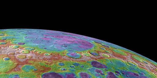
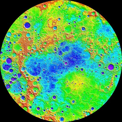
Measurements from NASA MESSENGER MLA instrument during the spacecraft greater than four-year orbital mission have mapped the topography of Mercury northern hemisphere in great detail. The view shown here is an interpolated shaded relief map of these data. The lowest regions are shown in purple, and the highest regions are shown in red. The difference in elevation between the lowest and highest regions shown here is roughly 10 kilometers!
NASA Image and Video Library’s own descriptionCredit lineThe Ups and Downs of Mercury Topography. NASA/JPL, 2015-04-16. Public domain. ID: PIA19420.