Public domain
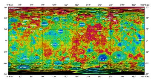
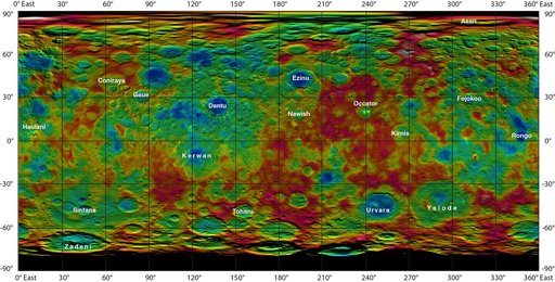
Topographic Ceres Map With Crater Names
From the collection of NASA Image and Video Library. Free to download, adapt and use — no permission needed.
About this work
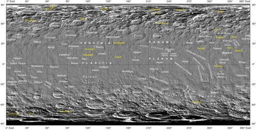
This color-coded map from NASA Dawn mission shows the highs and lows of topography on the surface of dwarf planet Ceres. It is labeled with names of features approved by the International Astronomical Union. Occator, the mysterious crater containing Ceres' mysterious bright spots, is named after the Roman agriculture deity of harrowing, a method of leveling soil.
NASA Image and Video Library’s own descriptionCredit lineTopographic Ceres Map With Crater Names. NASA/JPL, 2015-07-28. Public domain. ID: PIA19606.