Public domain
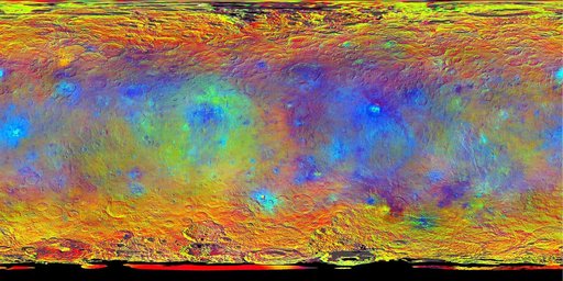
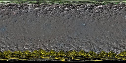
Colorized Map of Ceres Mercator Projection
From the collection of NASA Image and Video Library. Free to download, adapt and use — no permission needed.
About this work
The map is a Mercator projection and has a resolution of 460 feet 140 meters per pixel. The images used to make this map were taken from Dawn high-altitude mapping orbit HAMO, at a distance of 915 miles 1,470 kilometers from Ceres.
NASA Image and Video Library’s own descriptionCredit lineColorized Map of Ceres Mercator Projection. NASA/JPL, 2016-03-22. Public domain. ID: PIA20354.