Public domain
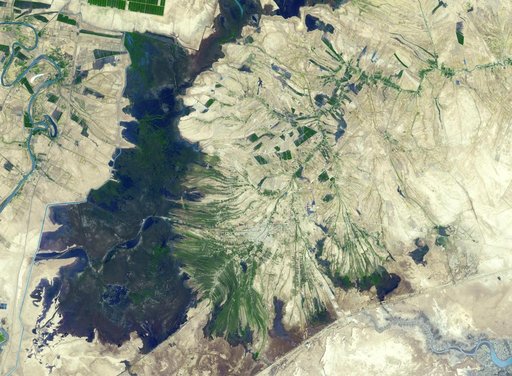
Shadegan, Iran
From the collection of NASA Image and Video Library. Free to download, adapt and use — no permission needed.
About this work
The town of Shadegan, Iran is northeast of where the Tigris and Euphrates Rivers enter the Persian Gulf. It sits near a wetland and upon land that was once part of an inland river delta. The long, linear orchards follow the topography created by the delta. The image was acquired September 3, 2012, covers an area of 40.6 by 55.3 km, and is located at 30.6 degrees north, 48.6 degrees east.
NASA Image and Video Library’s own descriptionCredit lineShadegan, Iran. NASA/JPL, 2016-11-15. Public domain. ID: PIA21170.