Public domain
Belize-Guatemala Border
From the collection of NASA Image and Video Library. Free to download, adapt and use — no permission needed.
About this work
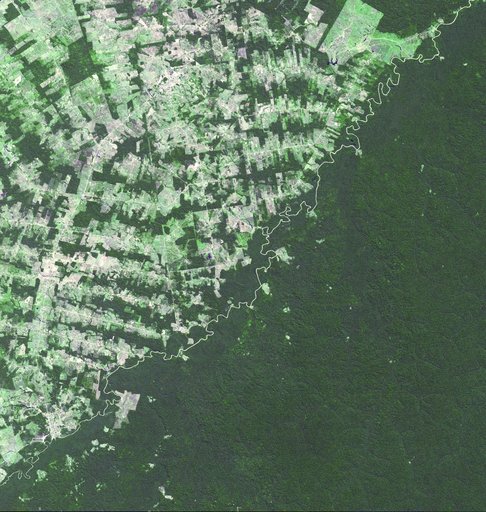
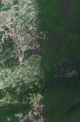
The border between Belize and Guatemala illustrates striking differences in land use practices. In a study of deforestation published in 2016, Chicas and co-authors found that in their study area between 1991 and 2014, on the Guatemalan side of the border forested land declined 32%; in Belize, forested area declined 11%. In part of their study area shown in this image, the difference is more dramatic: near-pristine forest in Belize on the right, and agricultural fields in Guatemala on the left.
NASA Image and Video Library’s own descriptionCredit lineBelize-Guatemala Border. NASA/JPL, 2017-08-29. Public domain. ID: PIA21826.