Public domain
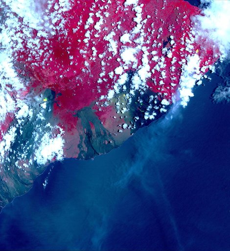
Satellite View of Kilauea Eruption
From the collection of NASA Image and Video Library. Free to download, adapt and use — no permission needed.
About this work
This image from NASA's Advanced Spaceborne Thermal Emission and Reflection Radiometer (ASTER) instrument on NASA's Terra spacecraft show recent eruptions of Kilauea volcano on the island of Hawaii (the Big Island). Following days of increased seismic activity, Kilauea erupted May 3, 2018, and triggered a number of additional fissure eruptions along the East Rift Zone.
NASA Image and Video Library’s own descriptionCredit lineSatellite View of Kilauea Eruption. NASA/JPL, 2018-05-07. Public domain. ID: PIA22450.