Public domain
Tonga Eruption Atmospheric Wave
From the collection of NASA Image and Video Library. Free to download, adapt and use — no permission needed.
About this work
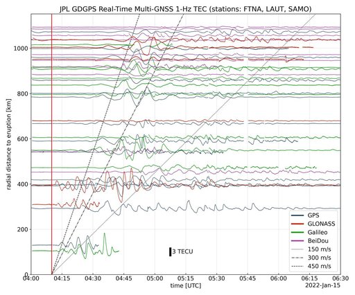
Real-time data collected by the Global Differential Global Positioning System network, operated by NASA's Jet Propulsion Laboratory, shows the atmospheric signature of the Hunga Tonga Hunga Ha'apai volcanic eruption in Tonga on Jan. 15, 2022. The data is a measure of the density of electrons (known as total electron content units, or TECU) in the ionosphere – the outermost layer of the atmosphere, which starts between 50 and 56 miles (80 to 90 kilometers) above Earth's surface.
NASA Image and Video Library’s own descriptionCredit lineTonga Eruption Atmospheric Wave. NASA/JPL, 2022-01-27. Public domain. ID: PIA24905.