Public domain
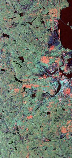
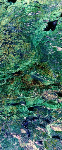
False-color composite image of Prince Albert, Canada
From the collection of NASA Image and Video Library. Free to download, adapt and use — no permission needed.
About this work
STS059-S-039 (11 April 1994) --- This is a false-color composite of Prince Albert, Canada, centered at 53.91 north latitude and 104.69 west longitude. This image was acquired by the Spaceborne Imaging Radar-C and X-Band Synthetic Aperture Radar (SIR-C/X-SAR) aboard the Space Shuttle Endeavour on its 20th orbit. The area is located 40 kilometers (25 miles) north and 30 kilometers (20 miles) east of the town of Prince Albert in the Saskatchewan province of Canada.
NASA Image and Video Library’s own descriptionSubjects
Credit lineFalse-color composite image of Prince Albert, Canada. NASA/JSC, 1994-04-11. Public domain. ID: sts059-s-039.