Public domain
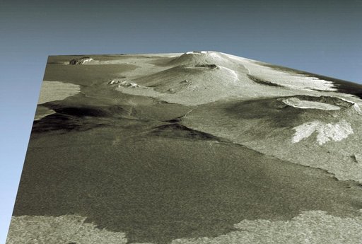
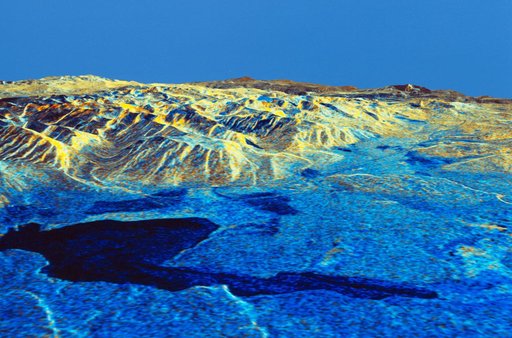
Three dimensional perspective view of Mammoth Mountain, California
From the collection of NASA Image and Video Library. Free to download, adapt and use — no permission needed.
About this work
STS059-S-084 (17 April 1994) --- This is a three-dimensional perspective of Mammoth Mountain, California. This view was constructed by overlaying a SIR-C radar image on a U.S. Geological Survey digital elevation map. Vertical exaggeration is 2x. The image is centered at 37.6 degrees north, 119.0 degrees west. It was acquired from the Spaceborne Imaging Radar-C and X-Band Synthetic Aperture Radar (SIR-C/X-SAR) onboard the Space Shuttle Endeavour on its 67th orbit, April 13, 1994.
NASA Image and Video Library’s own descriptionSubjects
Credit lineThree dimensional perspective view of Mammoth Mountain, California. NASA/JSC, 1994-04-17. Public domain. ID: sts059-s-084.