Public domain
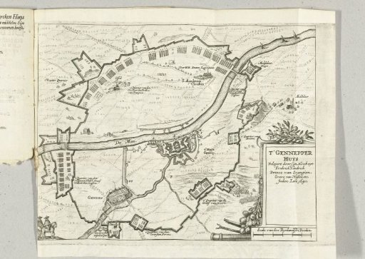
Map of the siege of Huis te Gennep, 1641
From the collection of Rijksmuseum, Amsterdam. Free to download, adapt and use — no permission needed.
About this work
Map with the House at Gennep, besieged and captured by the States Army under Frederick Henry, June 6 - July 27, 1641. With the circumvallation line of the besiegers, their camps and the nearby villages of Gennep, Oeffelt and Sint Agatha. Bottom right a cartouche with the title. The legend for the map is on the left next to the print on the reverse of the title page.
Rijksmuseum, Amsterdam’s own descriptionCredit lineKaart van het beleg van Huis te Gennep, 1641. 1641. Rijksmuseum, Amsterdam. Public domain.