Public domain
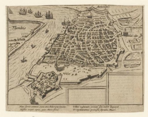
Spanish Fury: map of the city, 1576
From the collection of Rijksmuseum, Amsterdam. Free to download, adapt and use — no permission needed.
About this work
Plan of the city of Antwerp in bird's-eye view. From the citadel, Spanish soldiers storm the city. Details marked with numbers. In the lower right, two empty cartouches intended for the legend. With a four-line caption in Latin. Numbered: 63 (cut off). Printed on the reverse with text in Dutch. Subject categories within the Atlas of Customs and Manners: Military affairs; prints by Baudart. 80 Years' War.
Rijksmuseum, Amsterdam’s own descriptionSubjects
Credit lineSpaanse Furie: plattegrond van de stad, 1576. 1613 - 1615. anonymous. Rijksmuseum, Amsterdam. Public domain.