Public domain
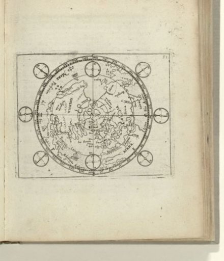
Map of the Northern Hemisphere
From the collection of Rijksmuseum, Amsterdam. Free to download, adapt and use — no permission needed.
About this work
Map of the northern hemisphere in a polar projection. The map follows the cartographic image of Mercator and shows several large islands at the North Pole that correspond to the then common idea of a polar continent consisting of several parts. Opposite page 51 in: 'Warhafftige Relation. Der dreyen newen unerhörten seltzamen Schiffart so die Holländischen und Seeländischen Schiff....Anno 1594, 1595 und 1596 verricht' (1598).
Rijksmuseum, Amsterdam’s own descriptionCredit lineKaart van het noordelijk halfrond. 1598. anonymous. Rijksmuseum, Amsterdam. Public domain.