Public domain
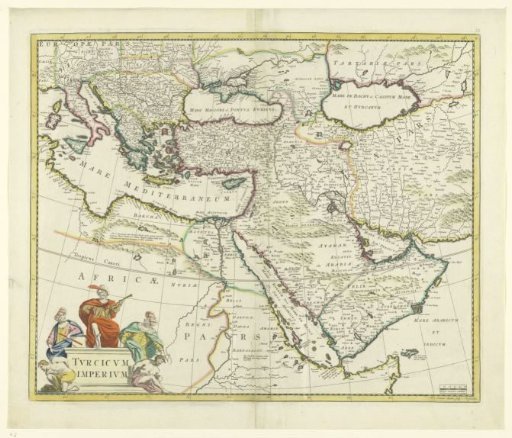
Map of the Turkish Empire
From the collection of Rijksmuseum, Amsterdam. Free to download, adapt and use — no permission needed.
About this work
Map of France (top left) to half of Iran, yellow border, borders colored, cartouche with inscription bottom left surrounded by three Eastern dignitaries and two white (European) prisoners. Bottom right scale in German miles.
Rijksmuseum, Amsterdam’s own descriptionSubjects
Credit lineKaart van het Turkse Rijk. 1650 - 1700. Joannes L'Huilier. Rijksmuseum, Amsterdam. Public domain.