Public domain
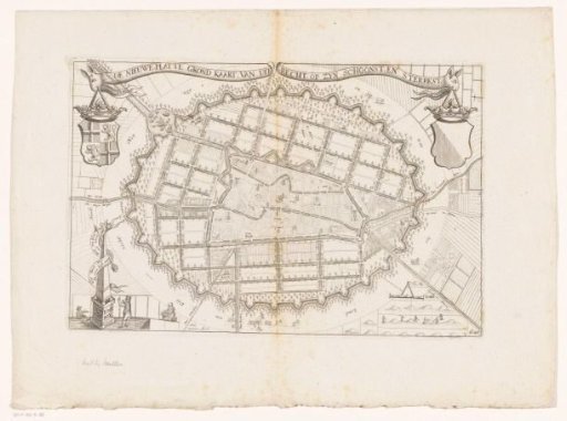
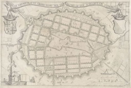
Plan of the city of Utrecht, 1670
From the collection of Rijksmuseum, Amsterdam. Free to download, adapt and use — no permission needed.
About this work
In the center, the plan of Utrecht with the title in a scroll above it. To the left of the plan, the coat of arms of the province of Utrecht, and to the right, the city coat of arms. Bottom left, an obelisk with the names of two makers and a scroll with the text: Wat Baet Het Bril aen biên. Als men dogh niet wil zien. Bottom right, a scale: 100 rods. At the very bottom right: fol. 26.
Rijksmuseum, Amsterdam’s own descriptionCredit linePlattegrond van de stad Utrecht, anno 1670. 1670. Anthonie de Winter. Rijksmuseum, Amsterdam. Public domain.