Public domain
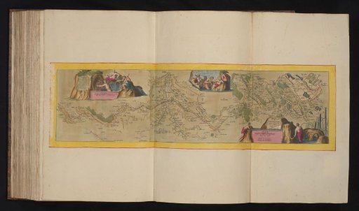
Map of the new canal from Pontgouin to Versailles, ca. 1693-1696
From the collection of Rijksmuseum, Amsterdam. Free to download, adapt and use — no permission needed.
About this work
Map of the new canal conveying water from the Eure river from Pontgouin to Versailles, ca. 1693-1696. With water nymphs and river gods. Print forms part of an album.
Rijksmuseum, Amsterdam’s own descriptionCredit lineKaart van het nieuwe kanaal van Pontgouin naar Versailles, ca. 1693-1696. 1693 - 1696. anonymous. Rijksmuseum, Amsterdam. Public domain.