Public domain
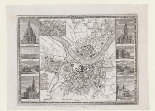
Map of Dresden with views of buildings in the city
From the collection of Rijksmuseum, Amsterdam. Free to download, adapt and use — no permission needed.
About this work
Upper left: an inset with a map of the surroundings of Dresden. Left and right: four views of important buildings of the city. Upper right marked: Meyers Städte Atlas No. 3.
Rijksmuseum, Amsterdam’s own descriptionCredit linePlattegrond van Dresden met gezichten op gebouwen in de stad. 1728 - 1774. Bibliographisches Institut. Rijksmuseum, Amsterdam. Public domain.