Public domain
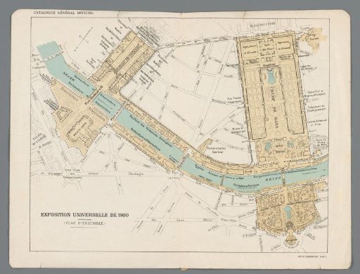
Overview map of the World's Fair 1900 in Paris
From the collection of Rijksmuseum, Amsterdam. Free to download, adapt and use — no permission needed.
About this work
Map of the area around the Seine where the World's Fair of 1900 took place. On the reverse side two detail maps: 'Plan No. VII: Beaux-arts' (the area around the Grand Palais and Petit Palais) and 'Plan No. VI Trocadéro'.
Rijksmuseum, Amsterdam’s own descriptionCredit lineOverzichtsplattegrond van de Wereldtentoonstelling 1900 in Parijs. 1900. anonymous. Rijksmuseum, Amsterdam. Public domain.