Public domain
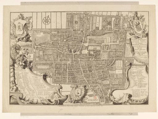
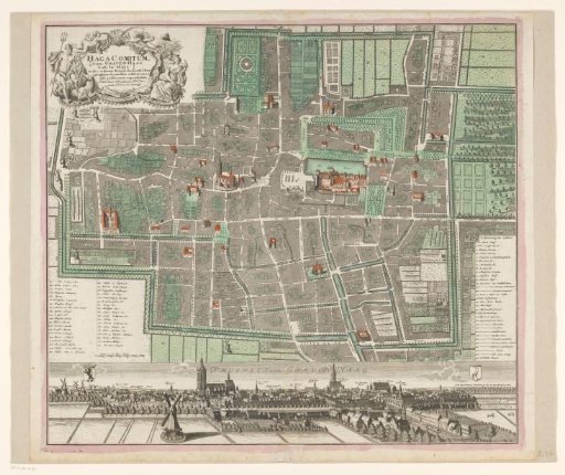
Map of The Hague with city view
From the collection of Rijksmuseum, Amsterdam. Free to download, adapt and use — no permission needed.
About this work
Plan with buildings in bird's-eye perspective. Upper left, the title cartouche. Lower left, a German legend 33–71 and a scale bar: Scala v. 60 Rh. Ruhten. Lower right, a German legend 1–32. Below the plan, a view of The Hague with the coat of arms of Holland in the upper left and the coat of arms of The Hague in the upper right.
Rijksmuseum, Amsterdam’s own descriptionCredit linePlattegrond van Den Haag met stadsgezicht. 1724 - 1806. anonymous. Rijksmuseum, Amsterdam. Public domain.