Public domain
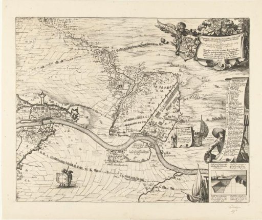
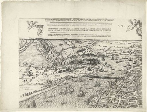
Large map of Antwerp with the failed attack of 1605 (sheet top left)
From the collection of Rijksmuseum, Amsterdam. Free to download, adapt and use — no permission needed.
About this work
Large bird's-eye view map of Antwerp with the failed attack by the States army on Antwerp, 17 May 1605. Fights on the Scheldt between Spanish boats and boats in the fleet of Count Ernst Casimir of Nassau. Various fire ships on the water, centrally the ship bridge. Top left heavy fighting at the Blokkersdijk. Entirely consisting of four sheets: sheet top left. At the top the four titles in Spanish, Dutch, Latin and French, an angel with a coat of arms and an angel with half of the central coat of arms of Philip II.
Rijksmuseum, Amsterdam’s own descriptionCredit lineGrote kaart van Antwerpen met de mislukte aanslag in 1605 (blad linksboven). 1569. Pieter van der Heyden. Rijksmuseum, Amsterdam. Public domain.