Public domain
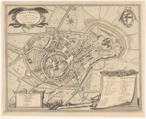
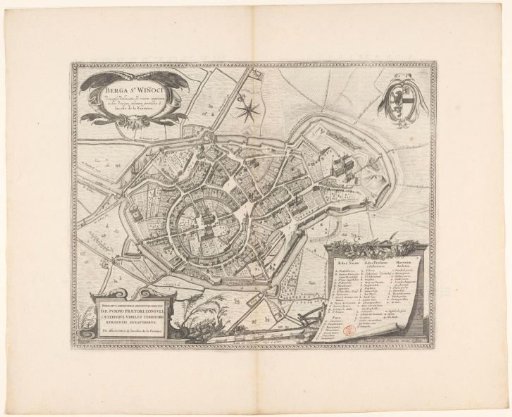
Map of Sint-Winoksbergen
From the collection of Rijksmuseum, Amsterdam. Free to download, adapt and use — no permission needed.
About this work
Map of Sint-Winoksbergen, also known as Bergen, with buildings in bird's-eye view. Top left the title cartouche. Top right the coat of arms of Sint-Winoksbergen. Bottom left a cartouche with dedication. Bottom right an extensive legend in the form of a sheet of paper. Below, in the center, two scale bars: Quarta pars pedis Bergensis / Scala 100 virgarum. virgae 14 pedum. The map is framed. With Dutch text on the verso.
Rijksmuseum, Amsterdam’s own descriptionCredit linePlattegrond van Sint-Winoksbergen. 1652. Jacobus de la Fontaine. Rijksmuseum, Amsterdam. Public domain.