Public domain
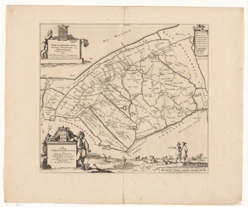
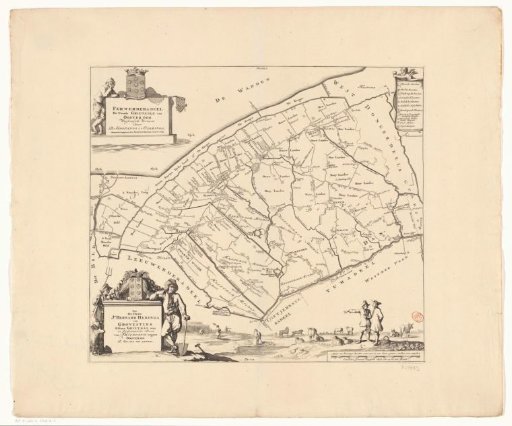
Map of the Grietenij Ferwerderadeel
From the collection of Rijksmuseum, Amsterdam. Free to download, adapt and use — no permission needed.
About this work
Title cartouche in the upper left, surrounded by the coat of arms of Ferwerderadeel and a fisherman with fishing nets. In the lower left, a cartouche with administrative information about the grietenij. Surrounding it, the coat of arms of grietman Jonker Bernard Heringa van Grovestins and two farmers. In the upper right, a legend; in the lower right, a scale bar: Measure of 1200 king's rods in an hour's walk, of which 1000 make a half common Dutch mile of 15 in a degree.
Rijksmuseum, Amsterdam’s own descriptionCredit lineKaart van de grietenij Ferwerderadeel. 1698. Caspar Luyken. Rijksmuseum, Amsterdam. Public domain.