Public domain
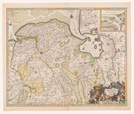
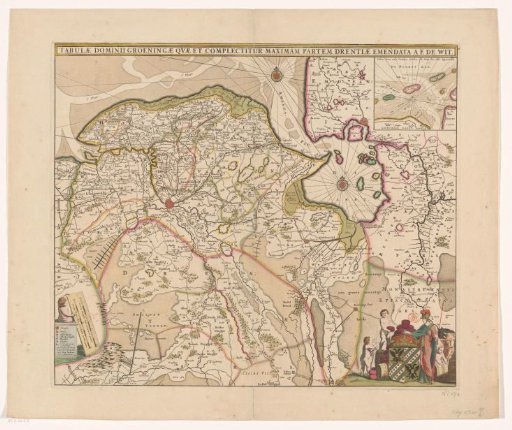
Map of the province of Groningen and part of Drenthe
From the collection of Rijksmuseum, Amsterdam. Free to download, adapt and use — no permission needed.
About this work
Bottom left legend and two scale bars: Common Dutch mile of 15 in a degree, Common French mile making an hour's walk. Top right inset map of the Wadden Sea area. Bottom right the coat of arms of the province of Groningen, surrounded by boys, cheeses, cattle, and Minerva.
Rijksmuseum, Amsterdam’s own descriptionCredit lineKaart van de provincie Groningen en een deel van Drenthe. c. 1670 - c. 1672. anonymous. Rijksmuseum, Amsterdam. Public domain.