Public domain
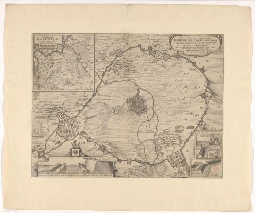
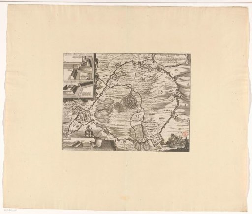
Map of the siege of Groenlo by Frederick Henry, 1627
From the collection of Rijksmuseum, Amsterdam. Free to download, adapt and use — no permission needed.
About this work
Siege and capture of the city of Groenlo (Grol) by the States Army under Frederick Henry, 6 July - 19 August 1627. Centrally, the city with the surrounding land and the quarters of the besiegers. In the upper left, an inset with two details of the ramparts and redoubts built by the army. Below it, the legend 1-16 of Frederick Henry's army camp. In the lower left, a cross-section of the city walls, above it the coat of arms of Groenlo. In the upper right, a cartouche with the title and a scale bar: Scale of 500 paces and 2.5 making a rod. In the lower right, a cavalry battle.
Rijksmuseum, Amsterdam’s own descriptionCredit lineKaart van het beleg van Groenlo door Frederik Hendrik, 1627. 1651. Pieter Hendricksz. Schut. Rijksmuseum, Amsterdam. Public domain.