Map of the City Freedom of Utrecht
From the collection of Rijksmuseum, Amsterdam. Free to download, adapt and use — no permission needed.
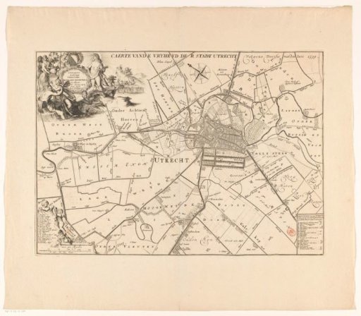
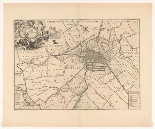
This plan depicts the jurisdictional freedom of the city of Utrecht (the area over which the city had jurisdiction) as it stood in 1539. The boundary of the jurisdiction is indicated with a dotted line. Top left, a cartouche with the Latin title and above it the coat of arms of the city. Around the cartouche, various mythological figures including Diana and Minerva (both to the left of the coat of arms in the background), Apollo, and a river god. Top left in the background, farmers at work. Bottom left, a legend with the buildings in the city and a scale bar: Scale of 500 rods. Bottom right, a legend with the bailiwicks and lower courts.
Rijksmuseum, Amsterdam’s own description