Public domain
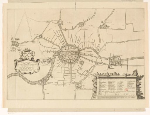
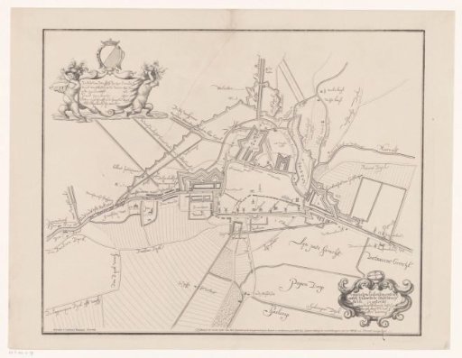
Plan of the city of Utrecht and fortifications
From the collection of Rijksmuseum, Amsterdam. Free to download, adapt and use — no permission needed.
About this work
Nineteenth-century stone print copy of an undated seventeenth-century manuscript map made following fortification plans from 1629. In the upper left, a cartouche with topographical information and mention of the scale used: Rijnlantsche maet. Above the cartouche, the coat of arms of the city of Utrecht. In the lower right, a cartouche with information about the map.
Rijksmuseum, Amsterdam’s own descriptionCredit linePlattegrond van de stad Utrecht en fortificaties. 1856. anonymous. Rijksmuseum, Amsterdam. Public domain.