Public domain
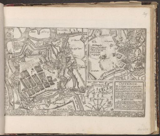
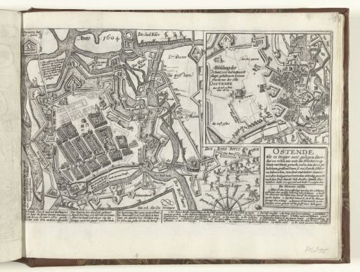
Map of Ostend, 1604
From the collection of Rijksmuseum, Amsterdam. Free to download, adapt and use — no permission needed.
About this work
Map of the besieged Ostend, June-July 1604. Plan of the city and the positions of the troops of Albert. Inset with depiction of fights around a bastion on the west side of the city on 16-17 July. Cartouche with title and text. With a caption of 12 lines in German and the legend of the numbers 1-25. Unnumbered.
Rijksmuseum, Amsterdam’s own descriptionCredit lineKaart van Oostende, 1604. 1604 - 1606. Rijksmuseum, Amsterdam. Public domain.