Public domain
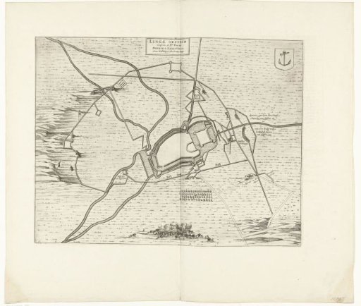
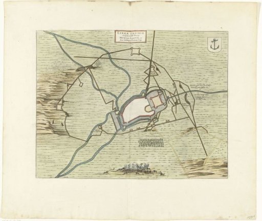
Map of Lingen with the fortifications, 1597
From the collection of Rijksmuseum, Amsterdam. Free to download, adapt and use — no permission needed.
About this work
Coloured map of Lingen with the fortifications, at the time of the siege and capture of the city by the States' army under Prince Maurice, 12 November 1597. At the bottom a cavalry battle, right the positions of Prince Maurice and Count William Louis. Taken from a double-page spread in the Stedenboek by Blaeu, printed on both sides with text in Dutch.
Rijksmuseum, Amsterdam’s own descriptionCredit linePlattegrond van Lingen met de versterkingen, 1597. 1647 - 1649. anonymous. Rijksmuseum, Amsterdam. Public domain.