Public domain
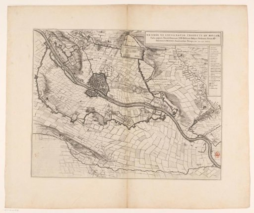
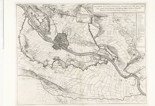
Map of the Siege of Maastricht, 1632
From the collection of Rijksmuseum, Amsterdam. Free to download, adapt and use — no permission needed.
About this work
Map of the siege of Maastricht by the States' army under Stadtholder Frederik Hendrik, 9 June to 21 August 1632. Showing the various camps of the besiegers. On the right, legend 1-13. Taken from a double-page spread in the Stedenboek by Blaeu, printed on the reverse with text in Latin.
Rijksmuseum, Amsterdam’s own descriptionCredit lineKaart van het beleg van Maastricht, 1632. 1649 - 1652. anonymous. Rijksmuseum, Amsterdam. Public domain.