Public domain
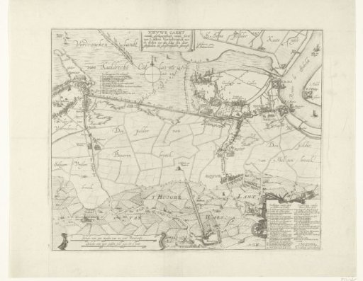
Map of the failed attack on Fort Kallo, 1638
From the collection of Rijksmuseum, Amsterdam. Free to download, adapt and use — no permission needed.
About this work
Map of the drowned land between the forts Kallo and Verrebroek with the failed attack by the States Army under Willem, Count of Nassau-Siegen, on fort Kallo, 21 June 1638. Bottom right a cartouche with the legend 1-30; top left at Verrebroek the legend a-l.
Rijksmuseum, Amsterdam’s own descriptionCredit lineKaart met de mislukte aanval op fort Kallo, 1638. 1638. anonymous. Rijksmuseum, Amsterdam. Public domain.