Public domain
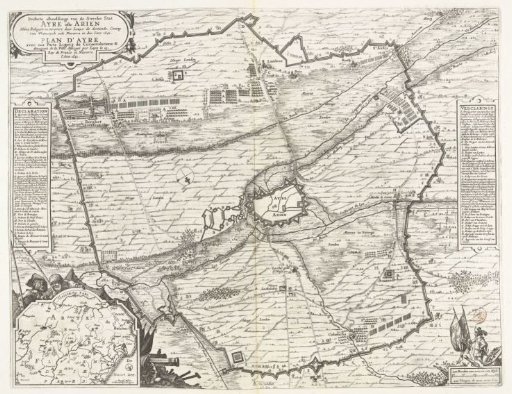
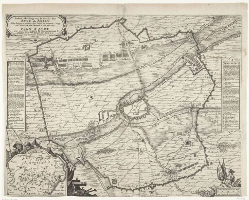
Map of the Siege of Aire-sur-la-Lys, 1641
From the collection of Rijksmuseum, Amsterdam. Free to download, adapt and use — no permission needed.
About this work
Map of the siege and capture of Aire-sur-la-Lys (Ariën) by the French army of King Louis XIII, May – 27 July 1641. Centrally a plan of the city with the fortifications and the surrounding land with the circumvallation line around the city laid by the besiegers. On the left and right the legends A–S in French and Dutch. Bottom left an inset with a map of the larger area. Unprinted on the back.
Rijksmuseum, Amsterdam’s own descriptionCredit lineKaart van het beleg van Aire-sur-la-Lys, 1641. 1641. Rijksmuseum, Amsterdam. Public domain.