Public domain
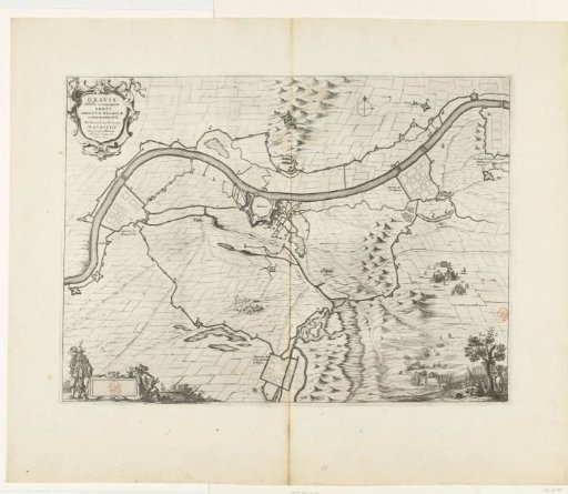
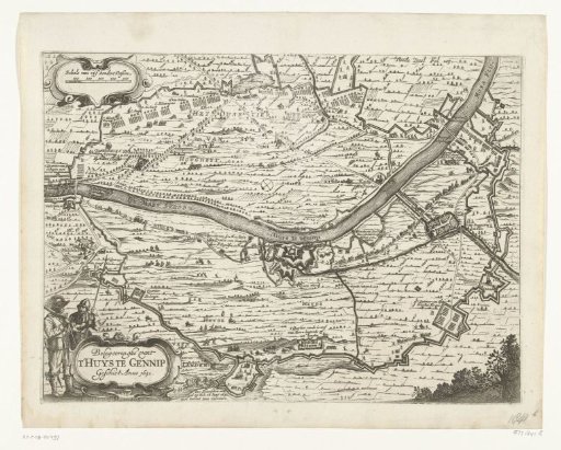
Map of the Siege of Gennep, 1641
From the collection of Rijksmuseum, Amsterdam. Free to download, adapt and use — no permission needed.
About this work
Map of Gennep with the House at Gennep and surroundings, besieged and captured by the States army under Frederick Henry, 6 June – 27 July 1641. With the circumvallation line of the besiegers and their army camps. Bottom left two soldiers at the cartouche with the title. Top right marked: Twede Deel Fol 103.
Rijksmuseum, Amsterdam’s own descriptionSubjects
Credit lineKaart van het beleg van Gennep, 1641. 1651 - 1652. anonymous. Rijksmuseum, Amsterdam. Public domain.