Public domain
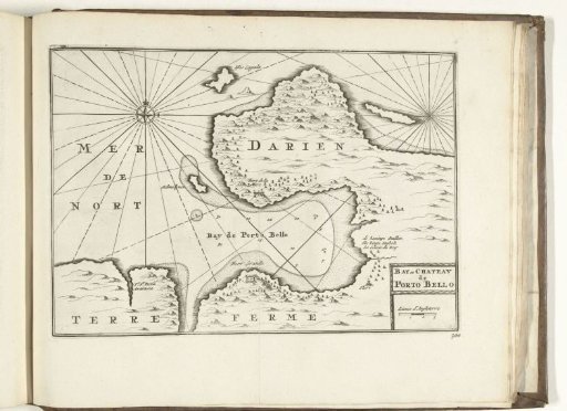
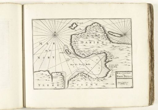
Map of the bay of Porto Bello in Panama, ca. 1702
From the collection of Rijksmuseum, Amsterdam. Free to download, adapt and use — no permission needed.
About this work
Map of the bay of Porto Bello and the Darién region in Panama. Plate no. 161 in the print work consisting in total of 276 numbered plates of famous strong cities and fortresses in the context of the War of the Spanish Succession. For the most part, these plates are copied from anonymous French plates: in Les forces de l'Europe and in: Le theatre de la guerre, dans les Pays-Bas, both originally published by Nicolas de Fer in Paris (1693-1697) in the context of the Nine Years' War. Title and inscriptions on the plate in French (partly also in Dutch and English).
Rijksmuseum, Amsterdam’s own descriptionCredit lineKaart van de baai van Porto Bello in Panama, ca. 1702. 1702 - 1703. anonymous. Rijksmuseum, Amsterdam. Public domain.