Public domain
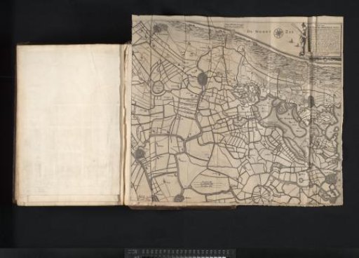
Historical map of a part of South and North Holland
From the collection of Rijksmuseum, Amsterdam. Free to download, adapt and use — no permission needed.
About this work
Historical map of part of South and North Holland and a small part of Utrecht (Rijnland, Zuid-Kennemerland, parts of Delftland, Amstelland, and the Sticht Utrecht), made after a 1591 copy of a map of the area from 1531. Top right, a cartouche with the title and explanation. Bottom left of center, three scale bars: Een groote myle; Een middelbare myle; Een cleyne myle. Orientation: north to the right. Print is part of a volume.
Rijksmuseum, Amsterdam’s own descriptionCredit lineHistorische kaart van een deel van Zuid- en Noord-Holland. 1644. Claes Jansz. Visscher (II). Rijksmuseum, Amsterdam. Public domain.