Public domain
Canary Islands
From the collection of NASA Image and Video Library. Free to download, adapt and use — no permission needed.
About this work
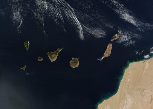
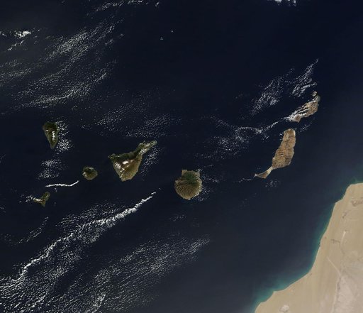
On December 10, 2013 the Moderate Resolution Imaging Spectroradiometer (MODIS) aboard NASA’s Terra satellite flew across the central Atlantic Ocean and captured a true-color image of the Canary Islands. Lying off of the coast of Western Sahara and Morocco, the islands were created by successive submarine volcanic eruptions which raised the ocean floor vertically until some of land rose above sea level. The oldest islands lie in the east and the youngest in the west.
NASA Image and Video Library’s own descriptionCredit lineCanary Islands. NASA/GSFC, 2017-12-08. Public domain. ID: GSFC_20171208_Archive_e001276.