Public domain
NIMS Ganymede Surface Map
From the collection of NASA Image and Video Library. Free to download, adapt and use — no permission needed.
About this work
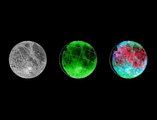
Galileo has eyes that can see more than ours can. By looking at what we call the infrared wavelengths, the NIMS (Near Infrared Mapping Spectrometer) instrument can determine what type and size of material is on the surface of a moon. Here, 3 images of Ganymede are shown. Left: Voyager's camera. Middle: NIMS, showing water ice on the surface. Dark is less water, bright is more. Right: NIMS, showing the locations of minerals in red, and the size of ice grains in shades of blue.
NASA Image and Video Library’s own descriptionCredit lineNIMS Ganymede Surface Map. NASA/JPL, 1998-03-26. Public domain. ID: PIA00500.