Public domain
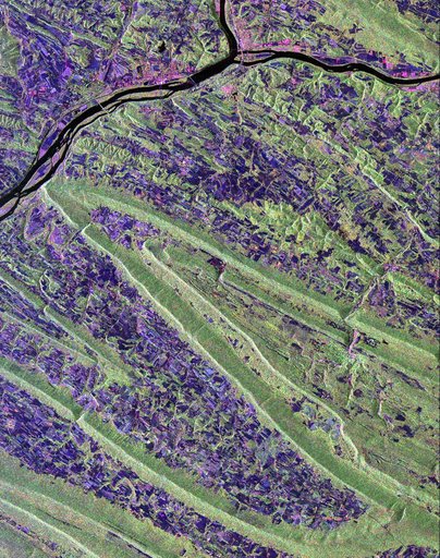
Space Radar Image of Sunbury, Pennsylvania
From the collection of NASA Image and Video Library. Free to download, adapt and use — no permission needed.
About this work
Scientists are using this radar image of the area surrounding Sunbury, Pennsylvania to study the geologic structure and land use patterns in the Appalachian Valley and Ridge province. This image was collected on October 6, 1994 by the Spaceborne Imaging Radar-C/ X-Band Synthetic Aperture Radar (SIR-C/X-SAR) on orbit 102 of the space shuttle Endeavour. The image is centered on latitude 40.85 degrees North latitude and 76.79 degrees West longitude. The area shown is approximately 30.5 km by 38 km.
NASA Image and Video Library’s own descriptionSubjects
Credit lineSpace Radar Image of Sunbury, Pennsylvania. NASA/JPL, 1998-04-14. Public domain. ID: PIA01306.