Public domain
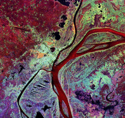
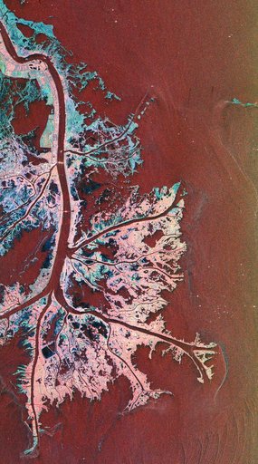
Space Radar Image of Mississippi Delta
From the collection of NASA Image and Video Library. Free to download, adapt and use — no permission needed.
About this work
This is a radar image of the Mississippi River Delta where the river enters into the Gulf of Mexico along the coast of Louisiana. This multi-frequency image demonstrates the capability of the radar to distinguish different types of wetlands surfaces in river deltas. This image was acquired by the Spaceborne Imaging Radar-C/X-Band Synthetic Aperture Radar (SIR-C/X-SAR) aboard the space shuttle Endeavour on October 2, 1995.
NASA Image and Video Library’s own descriptionSubjects
Credit lineSpace Radar Image of Mississippi Delta. NASA/JPL, 1999-04-15. Public domain. ID: PIA01784.