Public domain
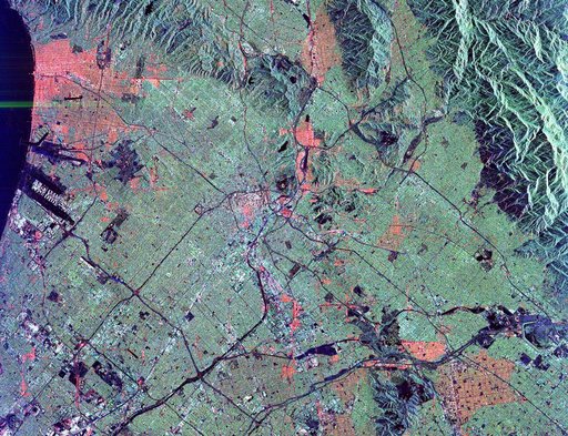
Space Radar Image of Los Angeles, California
From the collection of NASA Image and Video Library. Free to download, adapt and use — no permission needed.
About this work
This radar image shows the massive urbanization of Los Angeles, California. The image extends from the Santa Monica Bay at the left to the San Gabriel Mountains at the right. Downtown Los Angeles is in the center of the image. The runways of the Los Angeles International Airport appear as black strips at the left center of the image. The waterways of Marina del Rey are seen just above the airport. The San Gabriel Mountains and the city of Pasadena are at the right center of the image.
NASA Image and Video Library’s own descriptionSubjects
Credit lineSpace Radar Image of Los Angeles, California. NASA/JPL, 1999-04-15. Public domain. ID: PIA01789.