Public domain
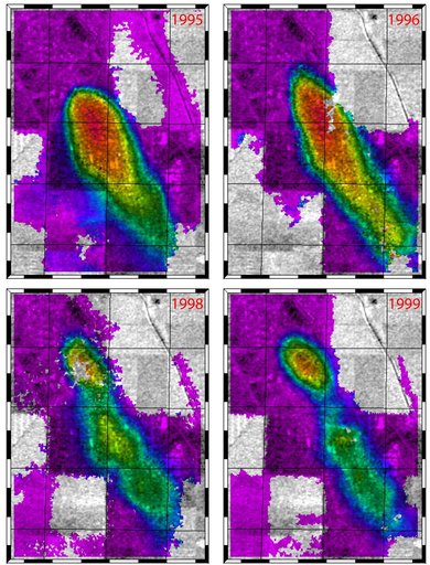
Lost Hills, California Interferogram
From the collection of NASA Image and Video Library. Free to download, adapt and use — no permission needed.
About this work
This figure shows a comparison of interferograms from four different years mapping the rapid ground subsidence over the Lost Hills oil field in California.
NASA Image and Video Library’s own descriptionSubjects
Credit lineLost Hills, California Interferogram. NASA/JPL, 2001-10-17. Public domain. ID: PIA03458.