Public domain
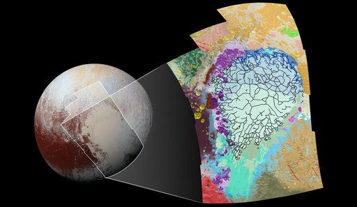
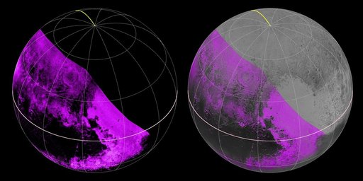
Mapping Pluto Methane Ice
From the collection of NASA Image and Video Library. Free to download, adapt and use — no permission needed.
About this work
The Ralph/LEISA infrared spectrometer on NASA's New Horizons spacecraft mapped compositions across Pluto's surface as it flew past the planet on July 14, 2015. On the left, a map of methane ice abundance shows striking regional differences, with stronger methane absorption indicated by the brighter purple colors, and lower abundances shown in black. Data have only been received so far for the left half of Pluto's disk.
NASA Image and Video Library’s own descriptionSubjects
Credit lineMapping Pluto Methane Ice. NASA/JPL, 2015-09-24. Public domain. ID: PIA19953.