Public domain
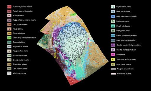
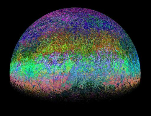
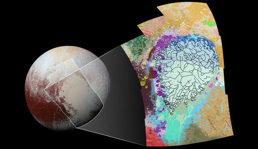
Putting Pluto's Geology on the Map
From the collection of NASA Image and Video Library. Free to download, adapt and use — no permission needed.
About this work
This geological map covers a portion of Pluto's surface that measures 1,290 miles (2,070 kilometers) from top to bottom, and includes the vast nitrogen-ice plain informally named Sputnik Planum and surrounding terrain. The map is overlain with colors that represent different geological terrains. Each terrain, or unit, is defined by its texture and morphology -- smooth, pitted, craggy, hummocky or ridged, for example.
NASA Image and Video Library’s own descriptionCredit linePutting Pluto's Geology on the Map. NASA/JPL, 2016-02-11. Public domain. ID: PIA20465.