Public domain
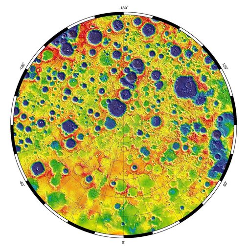
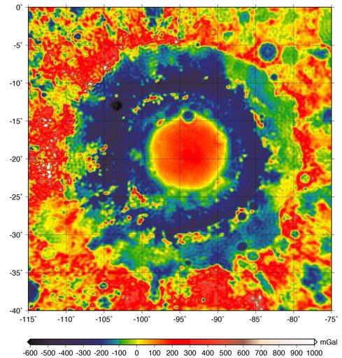
GRAIL Gravity Map of Orientale Basin
From the collection of NASA Image and Video Library. Free to download, adapt and use — no permission needed.
About this work
This color-coded map shows the strength of surface gravity around Orientale basin on Earth's moon, derived from data obtained by NASA's GRAIL mission. The GRAIL mission produced a very high-resolution map of gravity over the surface of the entire moon. This plot is zoomed in on the part of that map that features Orientale basin, where the two GRAIL spacecraft flew extremely low near the end of their mission.
NASA Image and Video Library’s own descriptionSubjects
Credit lineGRAIL Gravity Map of Orientale Basin. NASA/JPL, 2016-10-27. Public domain. ID: PIA21050.